When Nothing Goes Right – Go Left: An Introduction to Wayfinding
Introducing Wayfinding to the KSSB Community

Ok, so remember the old days before we all carried a mini GPS (via smartphone) in our pockets or purses? When you needed to travel somewhere unfamiliar, what did you do? Pull out an AAA map? Get on your desktop computer to check out “MapQuest”? Call a friend to ask for directions?
Thankfully, technology has evolved since those days. Enter smartphones with GPS. These tiny computers give step-by-step directions to help us get from unfamiliar place to unfamiliar place. We simply pull up a map app, enter an address in the search field, follow the directions Siri (or some other courteous voice gives us) and listen for the familiar “you have arrived” cue. We look up, see our destination, find the door and go on in.
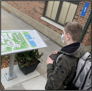
But what if you can’t see to confirm that you are in the correct location? What if your vision precludes you from finding the door? What if you don’t have any idea where you are to even begin?
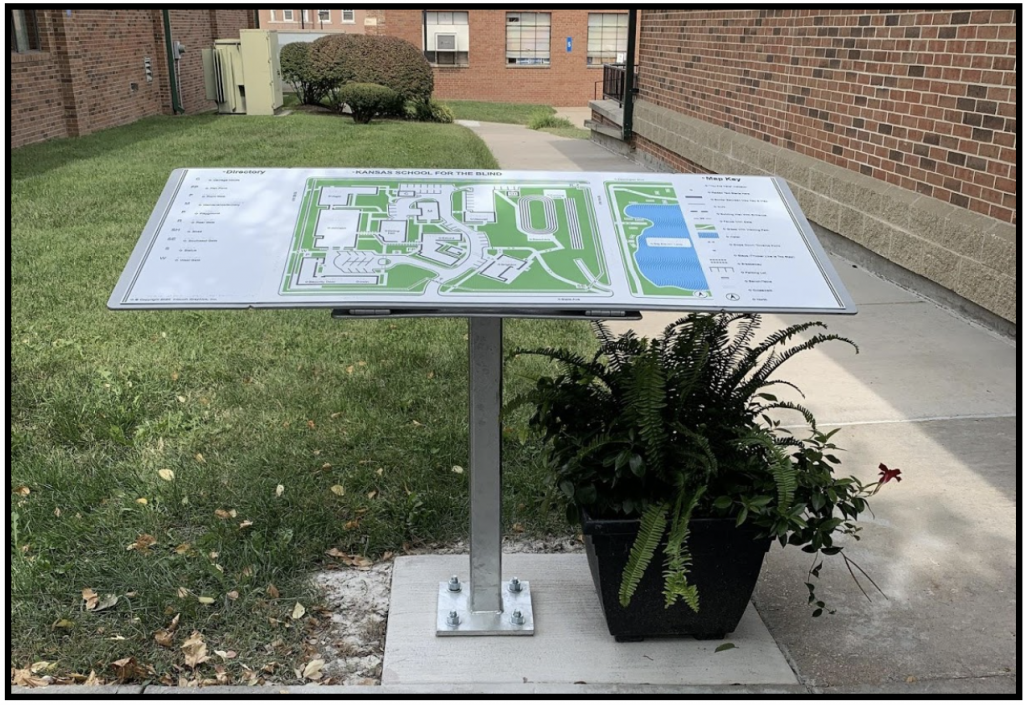
In 2020 the Kansas State School for the Blind worked to answer some of those challenges for our students and guests who are blind/visually impaired. KSSB partnered with ClickAndGo Wayfinding to design a state-of-the-art wayfinding system specific to our campus. This multi-tier system provides detailed environmental information that may not be accessible to those who have a visual impairment. The system offers over 160 routes for travel between common campus landmarks. Low vision maps are available for each route. iBeacons relay, to the listener, real-time audio messages both indoors and outdoors throughout the campus. These features are available on the free KSSB Wayfinding App, which is conveniently found in the Apple app store. One of our wayfinding system’s strongest features of our campus wayfinding system’s strongest features is not found in the app; it is physically located on campus. KSSB has three full-color, braille tactile maps for hands-on exploration. Students and visitors may learn the layout of buildings and features of which they were unaware before tactically exploring these state-of-the-art maps.
KSSB is excited about raising the playing field for all individuals with visual impairments to navigate and travel independently. This is just another example of how KSSB is fulfilling its mission to be a leader in the use of technology to promote access and empower students who are blind or who have a visual impairment. For more information contact Leah Enright at lenright@kssdb.org Download the Wayfinding APP on the App Store.